Our 2017 Norway Hike Rankings

We wanted to rank our hikes by scenery, challenge, length duration, elevation gain so others can gain from our experience.

Scenery:

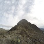
1. Romsdalseggen Ridge -Amazing, beautiful city view of Åndalsnes, & super green rivers!
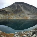
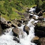
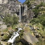
2. Mount Skala – Nice transition from forest, trees, streams, waterfalls, rocky terrain, and pure mountain bliss.
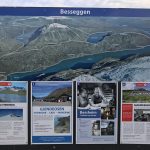
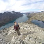
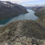
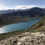
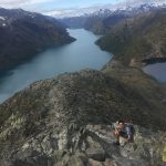
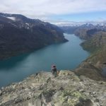
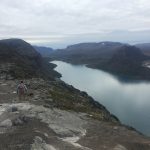
3. Besseggen Ridge – Awesome progressive climb to the the mountain wall, then you transition to a scramble.
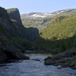
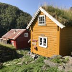
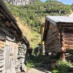
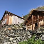
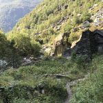
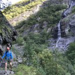
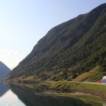
4. Aurlandsdalen Valley (lower route) – Very historical hike where you can see old farms that were renovated back to original state!
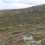
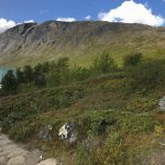
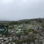
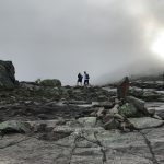
5. Middagsfjellet Oyenibba – Weather hindered this hike and it was very foggy, but the locals call this hike amazing.
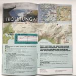
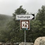
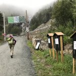
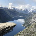
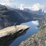
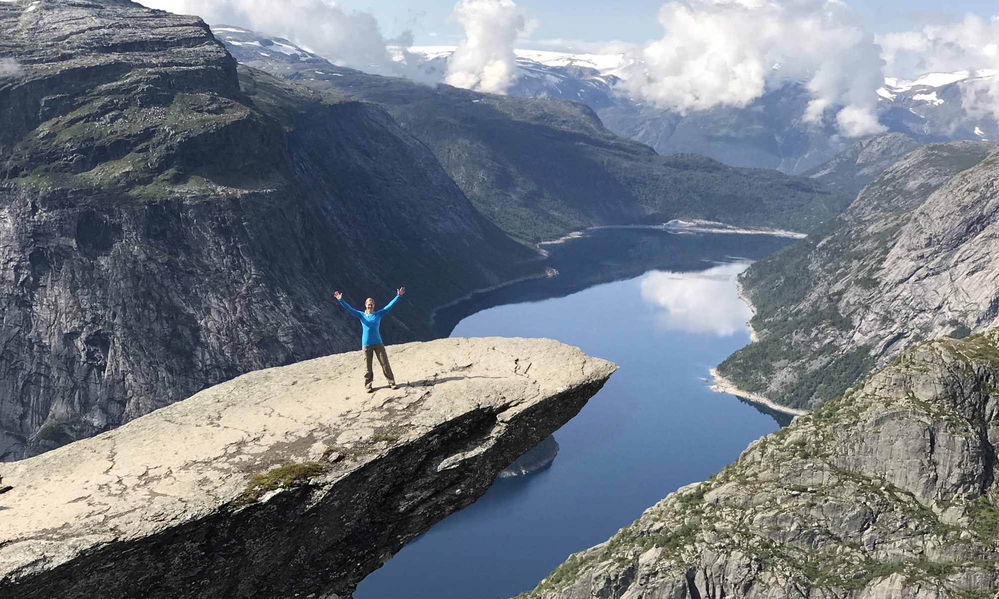
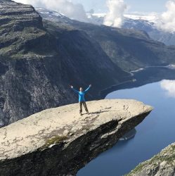
6. Trolltunga – Early morning conditions hindered this hike as well, but at the end it was amazing. From an overall hike experience perspective, I would rank the others higher.

Difficulty:

1. Mount Skala – extreme punishment on the body!
2. Trolltunga – length of hike made this brutal!
3. Romsdalseggen Ridge – tough climb up the mtn and ridgeline
4. Besseggen Ridge – challenging but not bad
5. Aurlandsdalen Valley (lower route) – relatively mild hike
6. Middagsfjellet Oyenibba

Length of Hike:

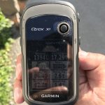
1. Trolltunga – 17.29 miles
2. Aurlandsdalen Valley (lower route) – 11.11 miles
3. Mount Skala – 10.89 miles
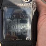
4. Besseggen Ridge – 9.77 miles
5. Romsdalseggen Ridge – 7.74 miles
6. Middagsfjellet Oyenibba – only completed partial up to 3 miles round trip

Time to complete hike:

1. Mount Skala – 8.5 hours
2. Trolltunga – 9.5 hours – 1.25 hrs waiting for photo = 8.25 hours
3. Romsdalseggen Ridge – 6.25 hours
4. Besseggen Ridge – 5 hours 49 minutes
5. Aurlandsdalen Valley (lower route) – 6 hours
6. Middagsfjellet Oyenibba – 2.75 hours

Elevation Gain:

1. Mount Skala – 6,562 feet
2. Trolltunga – 4,679 feet
3. Besseggen Ridge – 3,905 feet
4. Romsdalseggen Ridge – 3,182 feet
5. Aurlandsdalen Valley (lower route) – 2,967 feet
6. Middagsfjellet Oyenibba – 1,651 feet

SWE/NOR Jotunheimen Besseggen Ridge August 2017 (WD11)

Legendary Besseggen Ridge Hike in Jotunheimen National Park 8/31/17 –

Length: 15.72 km (9.77 miles) (note: Online research shows much less 13-14 km)
Time: 5 hrs 50 minutes (note: we were pretty conditioned by this point and we were on a tear!!! – online research shows 6-7 hrs + rest time)
Weather: Coldest hike of the trip, weather hovered around 55-65F

General Logistics:
We arrived to the Gjendebaten parking lot approximately 45 minutes early. Parking is not free (cost 120kr per day).
Ferry cost is one way: Adult 150kr. They have about 15 spots reserved for people who show up on the day of the hike. Get here early! It was a zoo late in August. A group of approximately 200 kids showed up in additional to the normal hikers.

Park here:

The ferry left sharply at 8:01am, and took approximately 20 minutes before we hit our stop half way down the lake. We exited off the boat and turned on our olympic speed-walking switch and raced for the start of the trail in order to get in front of the 200 kids. Mind you, we already amassed approximately 50 miles of hiking on our legs so we were very conditioned by this point. The start of the hike was similar to others, beginning with stair climbing through alpine terrain with streams and muddy ground. After a few kilometers we started to see the terrain level off. As we continued we arrived at a mountain wall where we climbed on all fours straight up. Daunting and equally mentally challenging if you have a fear of heights. Little known fact, I have some height anxiety issues but was able to overcome most of this by focusing on the challenge in front me. It was not easy but if I can do it anyone can do it.

This hike was the coldest hike that we faced in our week long adventure in Norway. So come with layers and windproof gear so you can stay warm. As we continued up the terrain we saw green colored signs that showed elevation and distance back to the parking lot. The trail was marked with rock pyramids and red paint. It’s a Norwegian tradition to take a rock and throw it on the pile to form a pyramid (https://en.wikipedia.org/wiki/Cairn).

The views in front were equally as stunning as behind us. About 2 hours into the hike, I noticed I put on my socks on inside out. I said, “no problem, let’s hike on!”

Once we got through the challenging spiderman crawling climb portion, the terrain leveled off at the ridgeline. We followed the trail for a few more kilometers until we started to descent. Typically the way down is more challenging on the knees, but this was nothing compared to the Romsdalseggen ridge hike – that was just brutal!!

Enjoy the views and pictures!

SWE/NOR Hiking Aurlandsdalen Valley (Vassbygdi to Osterbo) August 2017 (WD6)

Aurlandsdalen Valley Hike 8/26/17:

Started our day at 6 AM so we could catch a shuttle bus. Drove about an hour to the Vassbygdi bus station (see detail below). The lot was almost full by the time the bus arrived and we were getting worried there would be enough room for us. Fortunately a second bus showed up. The bus picked us up at 8:45 and drove us 30 min to Osterbo Inn. The trailhead was right off the parking area from this inn. The hike started out relatively flat. After a few miles the trail splits into two trails which meet up later on. We took the lower trail (left path) which went by a lake and river. It was a beautiful view from the bottom of the Aurlandsdalen Valley. There were several waterfalls along the way and hikers were drinking water from cups they filed at the falls. The trail became a lot more rocky with ascents and descents the further we hiked. There was an old farm with buildings that many hikers were exploring. Further down the trail there was another very old building sheltered by a big rock. The trail became more steep as it was descending towards Vassbygdi (starting location). We were feeling our hike from yesterday as our legs became fatigued. Hiking poles for the descent is a must as it is said to reduce strain on joints by 20%. Once we reached the car we threw on our sandals and immediately started driving. Mt Skala is next!

Logistics:
Hike Distances per GPS: From Inn (osterbo)-> Bus Stop (vassbygdi) = 11.11 miles and took us 6.25 hrs averaging around 1.8 miles per hour. I would say 6-8 hrs is a good range.
Get to Vassbygdi before 8:00 (parking spots are limited and they fill very quickly!)
Cost to park = zero
Wait for bus, bus cost is 100kr for two.
They will have two buses (during busy season) so do not stress out about room when you see a mob of people waiting around.
Enter bus and relax 8)


SWE/NOR Hiking Trolltunga August 2017 (WD5)

Trolltunga 8/25/17 – (Norwegians say Troll-hueg-ga)

Woke up at 5 AM or so and had breakfast at our hotel. We ate the famous Norwegian  brown cheese, which has a very creamy texture. We drove 45 min or so to the Trolltunga trail head. Trolltunga is named after a troll’s tongue. It’s was a game of cat and mouse while driving to the trailhead. The roads were extremely narrow. We parked in the main parking lot after not being able to find the upper parking lot due to a bus covering the entrance. The upper parking lot is a left turn from the main parking lot. We were told if you park in the upper parking lot you would shave 2 hours round trip off the hike. The cost for the main parking lot was 300 NOK and for the upper lot 500 NOK (both for 12 hours only)

The hike from the main parking lot started out with many switchbacks on a road. The journey to Trolltunga was pretty much all uphill, mostly a steady climb through a rocky and green landscape. It was fairly foggy on the way up. We were surprised on how few trees were around. This hike was heavily populated and there were several hundred people at the top. The combination of lots of people and lack of trees made it difficult to find a spot to pee. Fortunately the fog was clearing. The view from the top was incredible. There was a line to stand on the Trolltunga to capture a photo, which took about 75 min to get through. The hike back down was grueling and we could definitely feel it in our knees. We were limping by the time we reached the car. Total distance was 17 miles and it took just over 9 hours. After the hike we headed to Vinje Touristhotel. Enjoyed a Chinese dinner, organized our gear, and called it a night.

Specific Hiking Related Details to follow:

Trailhead: About 1-1.5 hours up the switchback road. Save time by turning up the hill by the Trolltunga Active store and paying 500NOK is highly recommended!

Cost as of August 2017 : 300NOKto park 12 hours in lower lot, 500NOK to park in upper lot for 12 hours (I highly recommend this option, you will save yourself 1 – 1.5hrs of walking a very draining switchback road)

Other things to note: Grueling Hike!! Check GPS picture data below.